
The Río Chillar and the Maro cliffs are the two best-known hiking routes near Nerja, about 8 and 12 km from Torrox-Costa. Before planning the river walk, bear in mind that Nerja Town Council has kept access to the Río Chillar riverbed closed since August 2023 for safety reasons and because of the fire risk, pending a capped-access system; the Maro cliffs, on the other hand, can be explored on short paths and trails down to the coves.
What’s more, a stretch of the Gran Senda de Málaga starts right at Milucar’s gate and takes you on foot all the way to the mouth of the Chillar, in Nerja. We explain the three options, how to get there and what to check before you set off.
Río Chillar, Maro cliffs and GR 249: at a glance
| Route | Distance from Milucar | Difficulty | Location |
|---|---|---|---|
| Río Chillar (riverbed towards Los Cahorros) | About 8 km, 12 min by car | Moderate, walking in the water | Access closed since August 2023; check before you go |
| Torre de Maro | About 13 km, 25-30 min by car | Easy, 1 km of path | Open |
| Path down to Cala del Pino | About 15 km by car | Moderate, 1 km steep descent | Open |
| GR 249 stage 4, Torrox – Nerja | Passes right by Milucar | Easy, 7.3 km | Open |
The Río Chillar: the route and the access situation
The Chillar flows down from the Sierra Almijara and reaches the sea at Nerja. Its classic route involves walking up the riverbed itself from the edge of town, feet in the water, to some very narrow gorges known as Los Cahorros. For years it was one of the most popular summer outings in the Axarquía, precisely for that reason: walking through water in the heat.
Is the Río Chillar open?
Access to the riverbed has been closed since August 2023. The Nerja Town Council is keeping it closed as a precaution to prevent the risk of forest fires, with Local Police and Civil Protection checks at the entrance, stepped up at weekends. Overcrowding and the rise in rescues in recent summers are also behind the closure.
The Junta de Andalucía is processing a concession to manage recreational use of the river with limited capacity and admission, in the style of other very popular natural sites. Until there is an official reopening, don’t go in on your own. If you’re interested in this route, check its status on the Nerja Town Council website or at the tourist office just before your visit.
If it reopens: how to prepare
- Closed footwear that can get wet and gives good ankle support: the ground is slippery stones.
- Quick-dry clothing, a dry bag for your phone and documents.
- Plenty of water, food and sun protection.
- Don't go after heavy rain in the mountains: the water level can rise quickly.
- Respect the capacity limit and opening hours set by the access system, and book if it’s compulsory.

The Maro cliffs: the nature area
East of Nerja begins the Acantilados de Maro-Cerro Gordo nature area, a narrow strip of coast between the municipalities of Nerja and Almuñécar. It was declared a Paraje Natural in 1989 and protects both land and sea: on land it reaches up to the N-340 road and out to sea it extends one mile.
According to Turismo de Nerja, the landscape alternates cliffs up to 75 metres high with small coves you reach on foot. As well as being a Paraje Natural, it is a Special Protection Area for Birds (SPA) and a Special Area of Conservation in the Natura 2000 network. With no roads along the sea, the best way to see it is on foot or from the water.

Walk to the Torre de Maro
It's the easiest walk for a look at the cliffs. The access is signposted at kilometre 297 of the N-340: you turn onto a dirt track between farmland and an Aleppo pine wood, and when you reach a wider spot you continue on foot along the path up to the watchtower. It's about a kilometre among thyme, rosemary and lavender, with views of the whole coast.
It's especially beautiful at sunset. It's a short route, suitable for almost everyone, but there's no shade: in summer, go early or late in the day.

Down to the coves: Cala del Pino
Within the nature area there are several coves, such as El Cañuelo, Cala del Pino, Las Alberquillas and Molino de Papel. Cala del Pino is a good example of what awaits you: according to Turismo de Nerja, you go down a path that starts at the third of the disused bends of the old N-340, past kilometre 299. It’s almost a kilometre of steep descent through pines and scrub, which you pay for on the way back up.
At the bottom you’ll find two gravel coves separated by rocks, about 350 metres in total, with few people precisely because of the tough access. Bring water, food and hiking boots, not flip-flops.
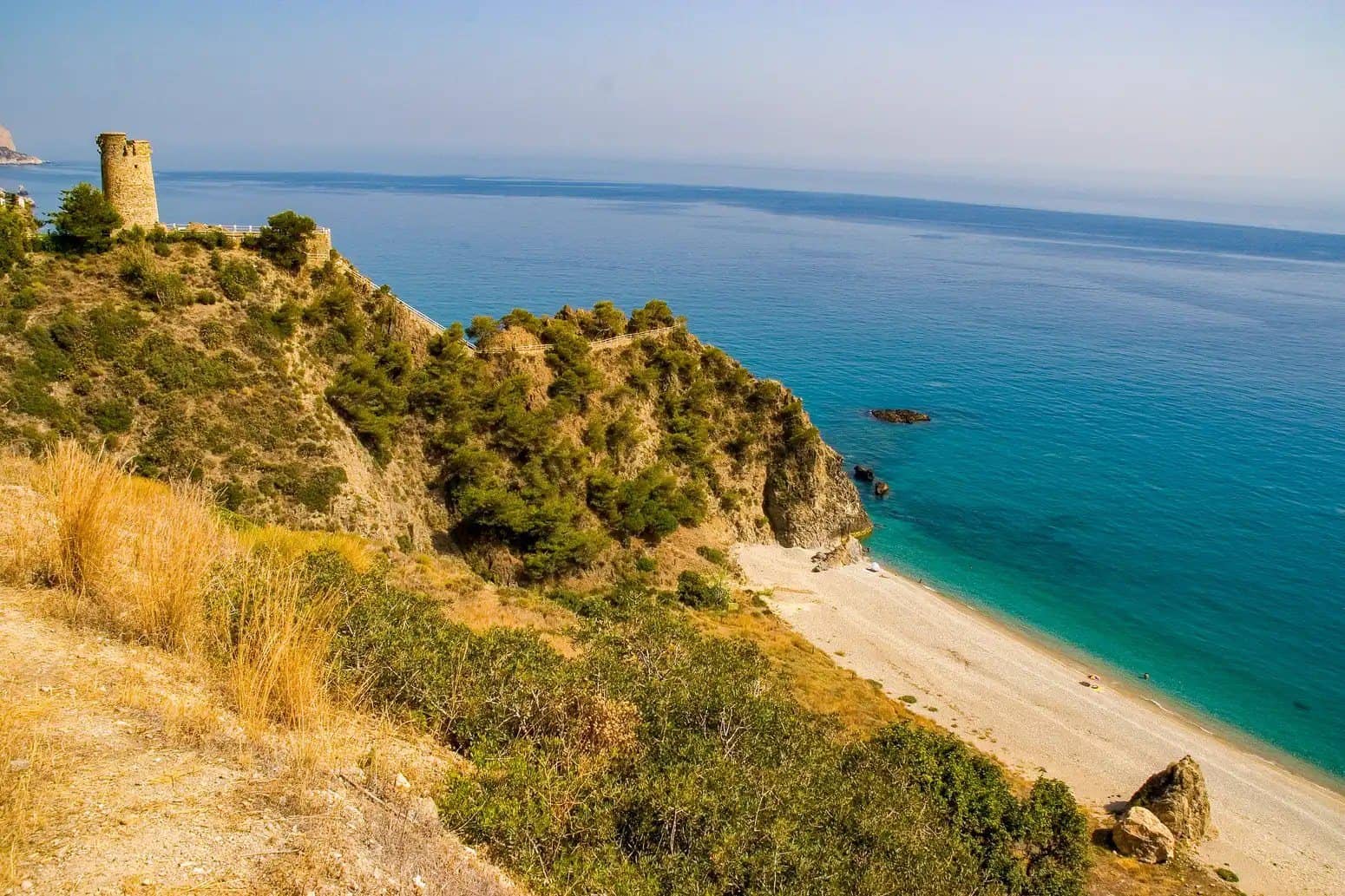
If you prefer a beach with easier access, Playa de Maro is also inside the nature area; we cover it in our guide to Playa de Maro.
Trail from Milucar to Nerja: GR 249, stage 4
This is the route you can do without getting into any vehicle. Stage 4 of the Gran Senda de Málaga starts at the Torrox lighthouse and ends at the Río Chillar riverbed in Nerja. According to the Málaga Provincial Council, it's 7.3 km, about 2 hours 10 minutes, rated easy and with very little climbing. The surface is tarmac and track, with a few stretches along the road verge.
After crossing the Río Torrox and passing some conglomerate cliffs, the trail drops down to Playa del Peñoncillo, right where Milucar is. So you can join the route at the aire’s gate. These are the main points:
| Point | Approx. km from the lighthouse | What you'll see |
|---|---|---|
| Faro de Torrox | 0 | Lighthouse and Roman site |
| Playa del Peñoncillo (Milucar) | 1,5 | Remains of the Cuartos Catalanes waterwheel |
| Cala de Mazagarrobo | 3,5 | Grey-sand cove and the Calaceite watchtower |
| Playa de Vilches | 5,5 | Hillsides with old stone walls |
| Torre de Macaca | 6,2 | Highest point, above a cliff |
| Playa del Playazo and Río Chillar | End | End of the stage by Nerja’s seafront promenade |
To get back, there are ALSA buses between Nerja and Torrox-Costa (check timetables at alsa.es), or you can walk back the way you came. If you carry on along Nerja’s seafront promenade you’ll reach the centre and the Balcón de Europa.
From Milucar: how to get there and where to park
- Río Chillar: about 8 km and 12 minutes along the N-340 to Nerja. It only makes sense to go once access has officially reopened.
- Maro and its cliffs: about 12 km and 18 minutes to Maro; the Torre de Maro, at km 297 of the N-340, is about 25-30 minutes away.
- GR 249: on foot from the gate, no vehicle needed.
With a motorhome, the sensible thing is not to move it: the access roads to the Torre de Maro and the coves are dirt tracks and old bends of the N-340 with little space, designed for cars. Go by car, taxi or bus to Nerja or Maro, or walk the GR 249. If you still want to stay overnight in the area, see our comparison of motorhome aires in and around Nerja.
When to go and tips
- Best time of year: Turismo de Nerja recommends doing the routes in its mountains between October and June, avoiding the hottest months. The same goes for the coast.
- Fire risk: in summer the countryside is very dry. Fires are not allowed and some areas may be closed temporarily.
- Water and shade: almost none of these routes has continuous shade. Carry at least a litre and a half per person.
- Respect the nature area: stay on the paths, don't leave litter and don't take plants or animals from the shore.
Milucar, your base for hiking in the Axarquía
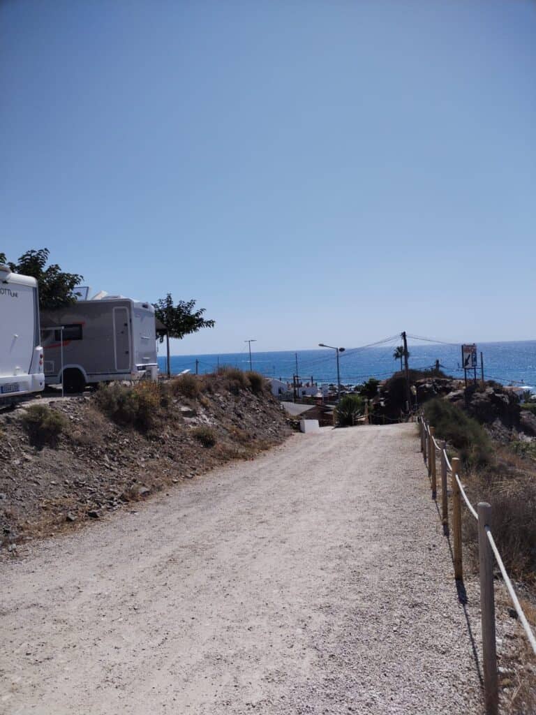
After a day on foot it’s good to come back to a pitch where everything is taken care of: showers, a washing machine and dryer for dirty clothes, Wi-Fi included to check the next day’s route, and the beach less than 100 metres away. Milucar is open 365 days a year and in the low season, the best for walking, there’s a discount from 30 nights.
Frequently asked questions
Can you do the Río Chillar route?
Access to the riverbed has been closed since August 2023 by decision of Nerja Town Council, for safety reasons and because of the fire risk. The Junta de Andalucía is working on a capped-access system. Check the situation on nerja.es before you go and don’t go in while it remains closed.
Can you walk from Torrox to Nerja?
Yes, on stage 4 of the Gran Senda de Málaga (GR 249): 7.3 km and about two hours from the Torrox lighthouse to the Río Chillar. From Milucar you join it at Playa del Peñoncillo, so the distance is a little shorter.
What is the easiest route along the Maro cliffs?
The one to the Torre de Maro: about a kilometre of path from the track that leaves the N-340 at km 297. It has very wide views and hardly any difficulty, although there’s no shade.
When is the best time for hiking near Nerja?
Between October and June. In summer, the heat and the fire risk make the routes harder, and some may be closed temporarily.
Can I take my motorhome to the Torre de Maro or the coves?
It's not advisable: the access roads are dirt tracks and old road bends with little space. Better to leave the motorhome at an aire and go by car, taxi or bus.
Walk from your pitch
With Milucar as your base you have the GR 249 at the gate, Maro a quarter of an hour away and Nerja ten minutes away. Check dates and book your pitch for your next hiking season.
 English (UK)
 Español
 Deutsch
 Nederlands
 Français
